


About Us
AI Geoservices (Pty) Ltd is a multidisciplinary geological and mining consulting firm dedicated to providing specialist geological services for the development and evaluation of mineral resources.
Building on a foundation of deep industry expertise, we prioritise transparency, agility, and technological advancement to deliver optimal outcomes for our clients.
We act as a trusted technical partner, supporting projects from initial discovery through to active mining operations.

Our Expert Solutions
Geology & Exploration Services
We provide comprehensive geological and exploration services tailored to your project needs, ensuring accurate data and insights for informed decision-making.
Technical Advisory & Reporting
We offer expert technical advisory and reporting services, delivering detailed analyses and recommendations to guide your projects and investments effectively.
Mining & Operational Support
Our mining operational support includes strategic planning, resource management, and on-site assistance to optimise your mining operations and enhance productivity.
Specialised Geophysics
Our specialised geophysics services utilise advanced techniques to provide critical insights into subsurface conditions, aiding in exploration and development efforts.
Core Service Offerings
01
GEOLOGICAL & EXPLORATION
-
Target generation & exploration planning
-
Drill program management & core logging
-
Sampling & QA/QC
-
3D geological modelling
-
Mineral Resource estimation
02
MINING & OPERATIONAL SUPPORT
-
Open-pit & underground mine design
-
Pit optimisation & reserve estimation
-
Mine layout & scheduling
-
Grade control solutions
-
Operational technical services
03
TECHNICAL ADVISORY & REPORTING
-
SAMREC / JORC compliant CPR
-
Regulatory Documents – Mining / Prospecting Work Programme
-
Due diligence & independent audits
-
Project reviews for investors
-
Financial modelling & feasibility
-
Strategic advisory services
04
SPECIALISED GEOPHYSICAL SERVICES
-
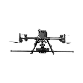
Drone-based aeromagnetic surveys
-
Ground-based (Mag, ERT, IP, Gravity)
-
LiDAR & Photogrammetry
-
Bathymetric Surveys
-
Geophysical data processing
-
Geophysical interpretation


Precision Geophysics · Insight-Led Exploration
Ryft Dynamics delivers geologically-informed aeromagnetic surveys that go beyond raw data. We translate subsurface signatures into actionable exploration intelligence. We bridge the gap between geophysical acquisition and meaningful geological interpretation, ensuring every survey dollar drives smarter decisions.